Piri Reis navigation book, 1525
Content: text (49 symbols)
Uploaded: 01.12.2018
Positive responses: 0
Negative responses: 0
Sold: 4
Refunds: 0
Seller: Protohistory
information about the seller and its items
Loyalty discount! If the total amount of your purchases from the seller more than:
| $30 | the discount is | 10% |
| $50 | the discount is | 15% |
| $100 | the discount is | 20% |
| $200 | the discount is | 25% |
| $300 | the discount is | 30% |
| $400 | the discount is | 35% |
| $500 | the discount is | 40% |
| $1000 | the discount is | 50% |
$1.46
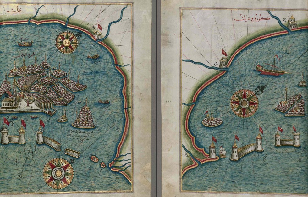
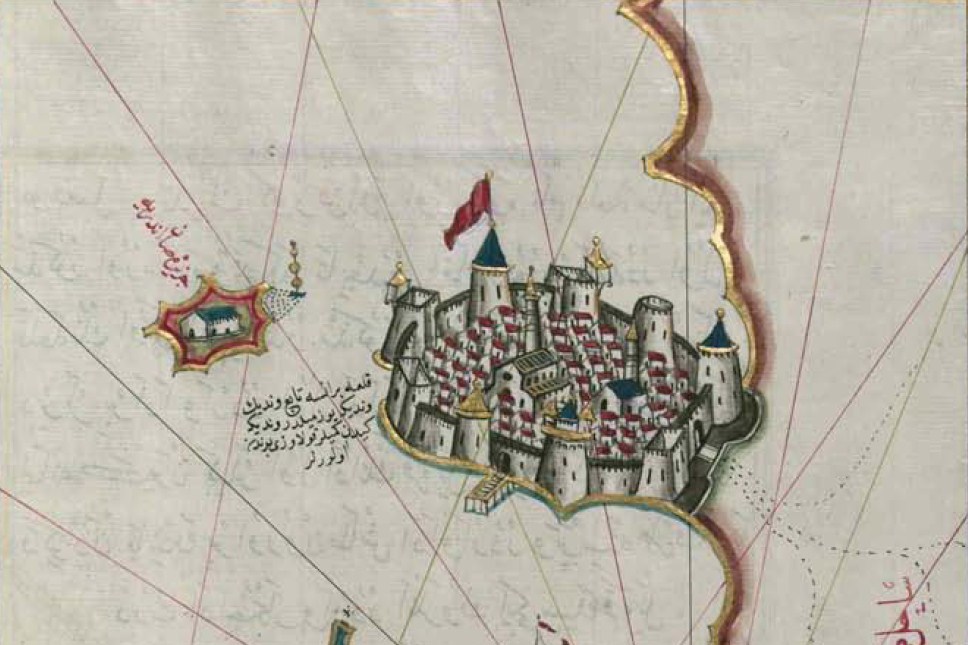
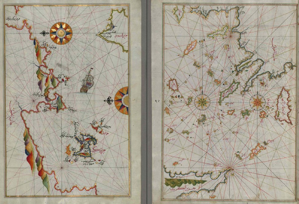
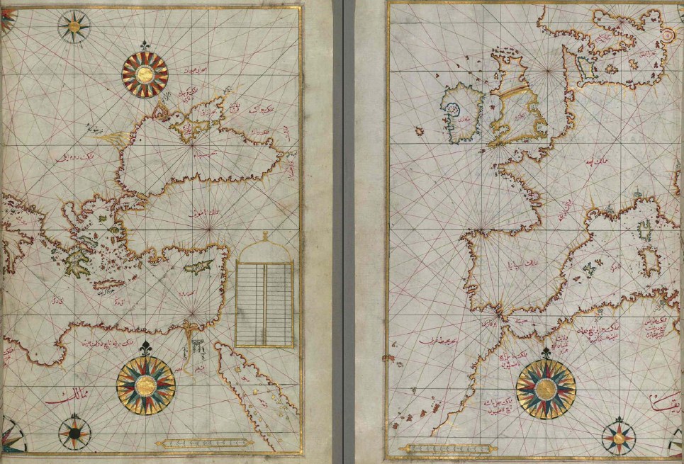
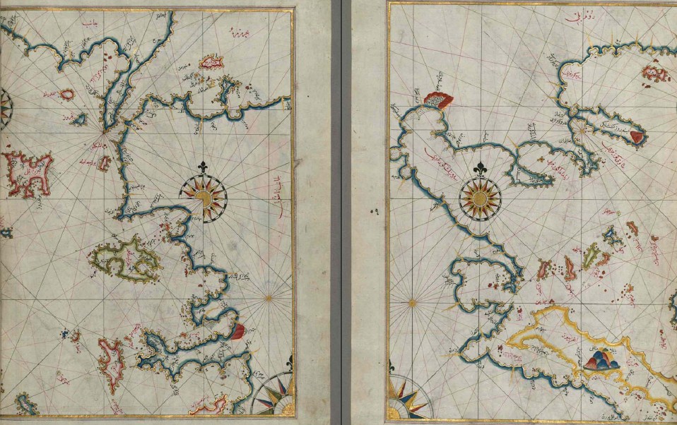
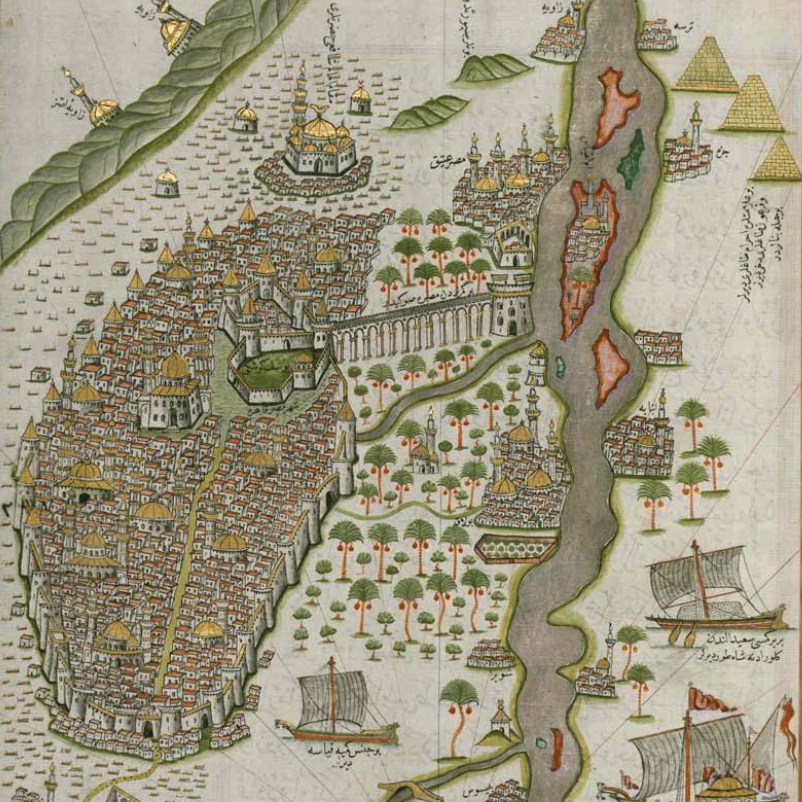
Originally written in 1525 and dedicated to Sultan Suleiman I (the Magnificent), this outstanding work on navigation, created by Piri Reis (died about 1554), was later revised and expanded. Piri Reis was born around 1470 in Gelibolu (Gallipoli) and later became the Ottoman admiral, geographer and cartographer. This manuscript, compiled mainly at the end of the 17th century, is based on a later enhanced version and contains about 240 skillfully crafted maps and portlanes. They include a map of the world with the outline of America (sheet 41a), maps of coasts with bays, capes and peninsulas, islands, mountains and cities of the Mediterranean and the Black Sea. The work begins with a description of the coast of Anatolia, the islands of the Aegean Sea, the Peloponnese peninsula, as well as the eastern and western coasts of the Adriatic Sea. It then goes on to describe the west coast of Italy, southern France, Spain and North Africa, the eastern Mediterranean, western Anatolia, various islands north of Crete, the Sea of Marmara, the Bosphorus and the Black Sea. The book ends with a map of the coast of the Caspian Sea, placed on page 374a.
No feedback yet